3 Day Forecast for Bretton Woods at 716m altitude
Issued: 6 pm Fri 31 Jan local time
Short Forecast for the next 3 days for 716 m altitude
Latest detailed forecast for Bretton Woods may be newer - updates every 6 hours
A light covering of new snow, mostly falling on Sat night. Freeze-thaw conditions (max 1°C on Sun morning, min -12°C on Sun night). Winds decreasing (strong winds from the SW on Sat night, light winds from the WNW by Mon morning).
| Snow (cm) | Rain (mm) | Max °C | Min °C | Wind km/h | Chill °C | Freezing level m | Sunrise | Sunset | ||
| Fri after- noon (31st) | - | - | 0 | - | 16:53 | |||||
| Fri night (31st) | - | - | 0 | - | - | |||||
| Sat morn- ing (01st) | - | - | 0 | 7:03 | - | |||||
| Sat after- noon (01st) | - | - | 0 | - | 16:54 | |||||
| Sat night (01st) | 5 | - | 0 | - | - | |||||
| Sun morn- ing (02nd) | - | - | 900 | 7:01 | - | |||||
| Sun after- noon (02nd) | - | - | 450 | - | 16:55 | |||||
| Sun night (02nd) | - | - | 0 | - | - | |||||
| Mon morn- ing (03rd) | - | - | 0 | 7:01 | - |
Latest detailed forecast for Bretton Woods may be newer - updates every 6 hours
Day 3 to 6 forecast for 716 m altitude
A heavy fall of snow, heaviest during Wed morning. Temperatures will be below freezing (max -3°C on Wed afternoon, min -14°C on Wed night). Winds increasing (calm on Tue night, strong winds from the NW by Wed night).
Latest detailed forecast for Bretton Woods may be newer - updates every 6 hours
Day 6 to 9 forecast for 716 m altitude
A light covering of new snow, mostly falling on Sat night. Becoming milder with light rain (total 5.0mm) on Sun afternoon. Freeze-thaw conditions (max 3°C on Sun afternoon, min -22°C on Thu night). Mainly strong winds.
| Summary Snow Report for Bretton Woods | |
|---|---|
| Report origin: No report. Get free membership by becoming a snow reporter! Can you update this report? Submit a user report here | |
| Date of Report: 01/31/2014 | Piste Condition: Packed Powder |
| Lower Slopes: 46 cm | Off Piste: - |
| Upper Slopes: 91 cm | Date Last Snow: |
| Comments: - | |
| Nearest new snow reported: 105 km | |
| Nearest powder reported: 105 km | |
About this report
This email contains the mid-elevation forecast for Bretton Woods at the time the alert was triggered (6 pm Fri 31 Jan local time). Visit the Bretton Woods forecast page for updated snow reports as well as revised forecasts for 716m as well as top (945m) and bottom (488m) altitudes. Forecasts update every 6 hours
We won't send you another alert for at least 3 days from now to avoid too much email clutter in your inbox - even if the prospect of snow changes. We suggest that you regularly visit the Bretton Woods forecast page. This provides much more detailed top, middle and bottom lift elevation forecasts and is updated every 6 hours.
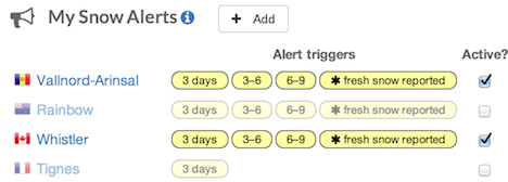
You can manage your snow alerts by visiting the snowmail page.

